Image:Treeclimbing Possible Loc 2.jpg
From Chaos Communication Camp 2007

Treeclimbing_Possible_Loc_2.jpg (47KB, MIME type: image/jpeg)
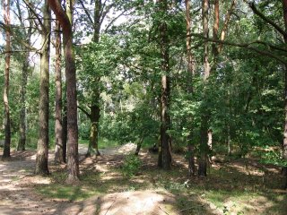
A suggested location for Treeclimbing (#2), at 52°50.0253'N, 13°40.7197'E
File history
Legend: (cur) = this is the current file, (del) = delete
this old version, (rev) = revert to this old version.
Click on date to see the file uploaded on that date.
- (del) (cur) 14:50, 9 August 2007 . . Klystron (Talk | contribs) . . 320×240 (47,725 bytes) (A suggested location for Treeclimbing (#2), at 52°50.0253'N, 13°40.7197'E)
- Edit this file using an external application
See the setup instructions for more information.
Links
The following pages link to this file:
