3D Map
From Chaos Communication Camp 2007
Contents |
[edit] Google Earth 3D Map
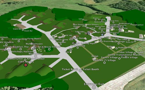
3D Camp Map, viewable and browsable with Google earth version > 4. Have fun. Please toggle the Layer "Terrain" off - the Terrain information from Google Earth is not correct - otherwise a part of the camp will vanish into the Ground.
[edit] Version
version 0.6 contains
- Camp Area
- Basic Places
- Villages that provided useful location information in the wiki
- Some more Projects
- Some food places
- Big Tents and Containers
- first Panoramas
- first small tents
- Microkopter airphotos
[edit] Send me your Placemark
Link your Placemark here or send me your Placemark via email. There is also a Map at the Information where you can mark your Project/Village.
Geraffel Village:
52°49'53.92"N
13°40'36.33"E
(near Dylan)
[edit] Help
would be nice to link some photos/panoramas later. maybe a cheap LAMP database will follow to make things easier. if you want to help me, please let me know.
